Navigating Haiphong Map Districts And Areas
Look at a haiphong map for the first time and it can feel confusing. The city spreads from a busy river port in the center to beaches in the south-east, rice fields in the west and a whole island world out in the bay. Names change from district to district, and the main sights are not all in one walkable cluster like in some other Vietnamese cities.
This guide turns that map into a simple mental picture. You will learn how the city is laid out, which areas matter for visitors, how far apart the main places are, and how to link them into easy days. Whether you plan to explore alone or join one of our local haiphong tours, a clear picture of the layout saves time, money and wrong turns.
The Big Picture: How The Haiphong Map Is Organized
Haiphong is a port city on the northern coast of Vietnam, roughly two hours by road from Hanoi. Rivers shaped the whole layout. The Cam River runs along the northern edge of the old center and carries ships out toward the sea, while smaller waterways and canals cut through the surrounding neighborhoods.
A simple way to read the map is in three rings. The inner ring is the old French-era center with wide avenues, colonial buildings and most of the cafes and restaurants. The middle ring is the modern city, with newer residential areas, shopping streets and the airport. The outer ring is the countryside, the coast and the islands, where you find beaches, villages and national park scenery.
One practical note. Vietnam reorganized many local administrative units in 2025, and Haiphong was enlarged when it merged with neighboring Hai Duong province. Ward and district names on official maps may therefore differ from the older names used on signs, in guidebooks and by drivers. This article uses the familiar district names that locals and travelers still use. For paperwork or booking addresses, always check the current name on an up-to-date map.
Ngo Quyen: The Colonial Heart Of The City
If you only have time for one area on the map, choose Ngo Quyen. This is the compact center where most visitors spend their first day. Wide boulevards, shady trees and French-style buildings give it a relaxed, slightly nostalgic feel.
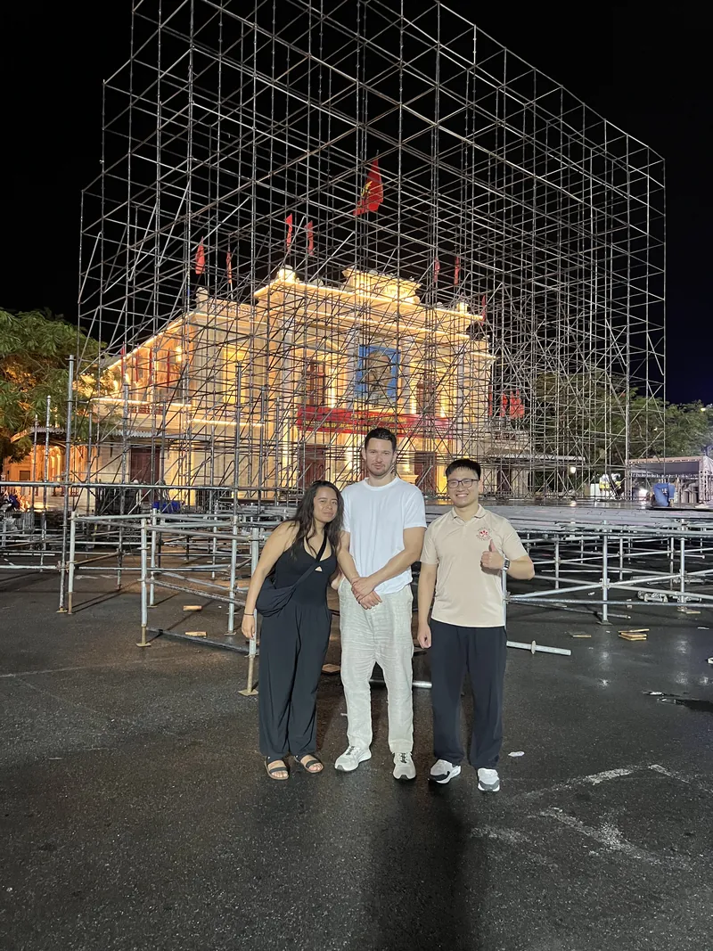
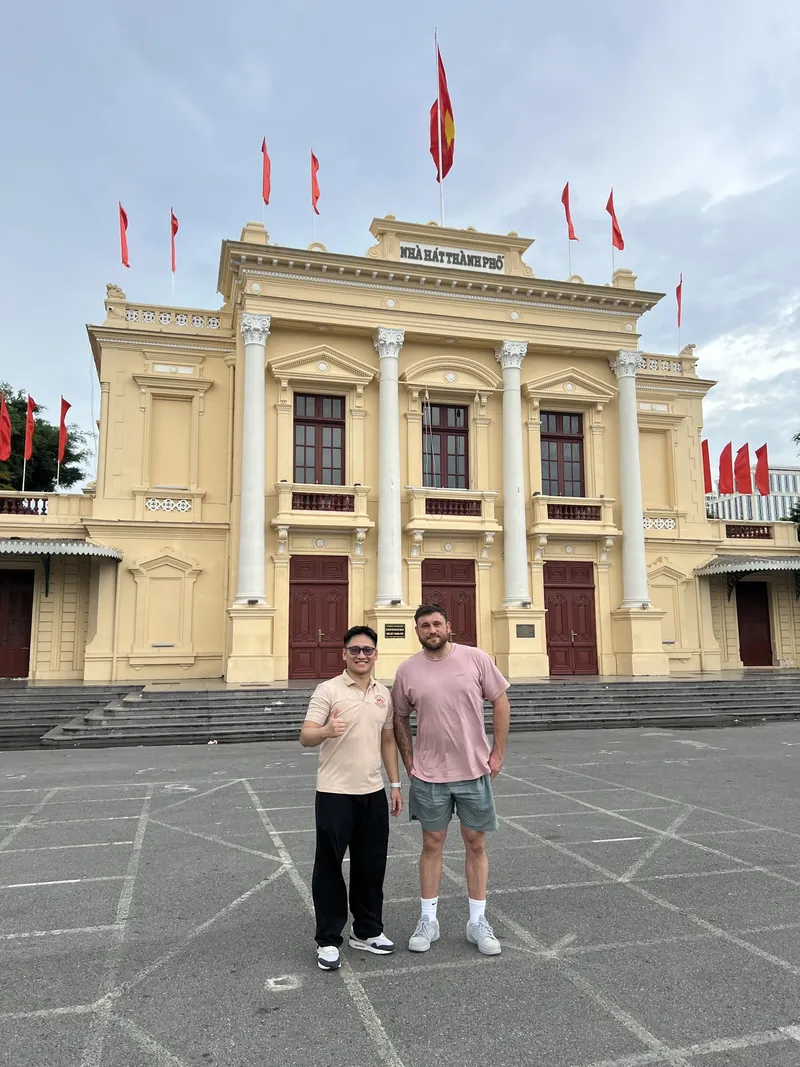
The anchor here is Haiphong Opera House, a yellow colonial theater that dates from the early twentieth century and faces a large public square. Locals gather there in the evening to chat, take photos and cool off after the heat of the day. Nearby you will find the City Post Office, the municipal buildings and a short run of cafes that are perfect for a first iced coffee.

Ngo Quyen works well for walkers. Most sights are within ten to fifteen minutes of each other on foot, so you can use a simple loop: Opera House, post office, a coffee stop, then a slow wander through the side streets. If you want a ready-made route, our half-day Haiphong tour itinerary follows exactly this area and adds the best food stops.
>>> 24-Hour DIY Haiphong Tour: The Ultimate Guide
Hong Bang And The Cam River Waterfront
North and east of the center, Hong Bang district runs along the Cam River. This is the working port side of the city, and it gives you a very different feeling from the elegant avenues of Ngo Quyen. Cranes, cargo ships, ferry landings and old warehouses line the water.
For visitors, the highlight is the riverside promenade near Hoang Van Thu Bridge. In the evening the bridge is lit up and families, couples and groups of friends stroll along the water. It is an easy, free way to see how people actually spend their evenings in Haiphong.

Hong Bang is also where you find Cau Quay, the old swing bridge that once opened to let boats pass. The railway tracks on the bridge and the street murals at its foot make this one of the most photographed corners of the city. Go in the early morning or at dusk for softer light and fewer people.

Please stay alert near the tracks and keep an eye on traffic, because the area is still in everyday use. Our guide to the cultural things to do in Haiphong explains the stories behind the bridge and other landmarks in this part of town.
Le Chan And Kien An: Local Life Away From The Center
South of the center, Le Chan district is named after Le Chan, a female general who is remembered in local history. A golden statue of her stands in a square that is especially lively at night, when locals gather to eat snacks, ride bikes and take photos.

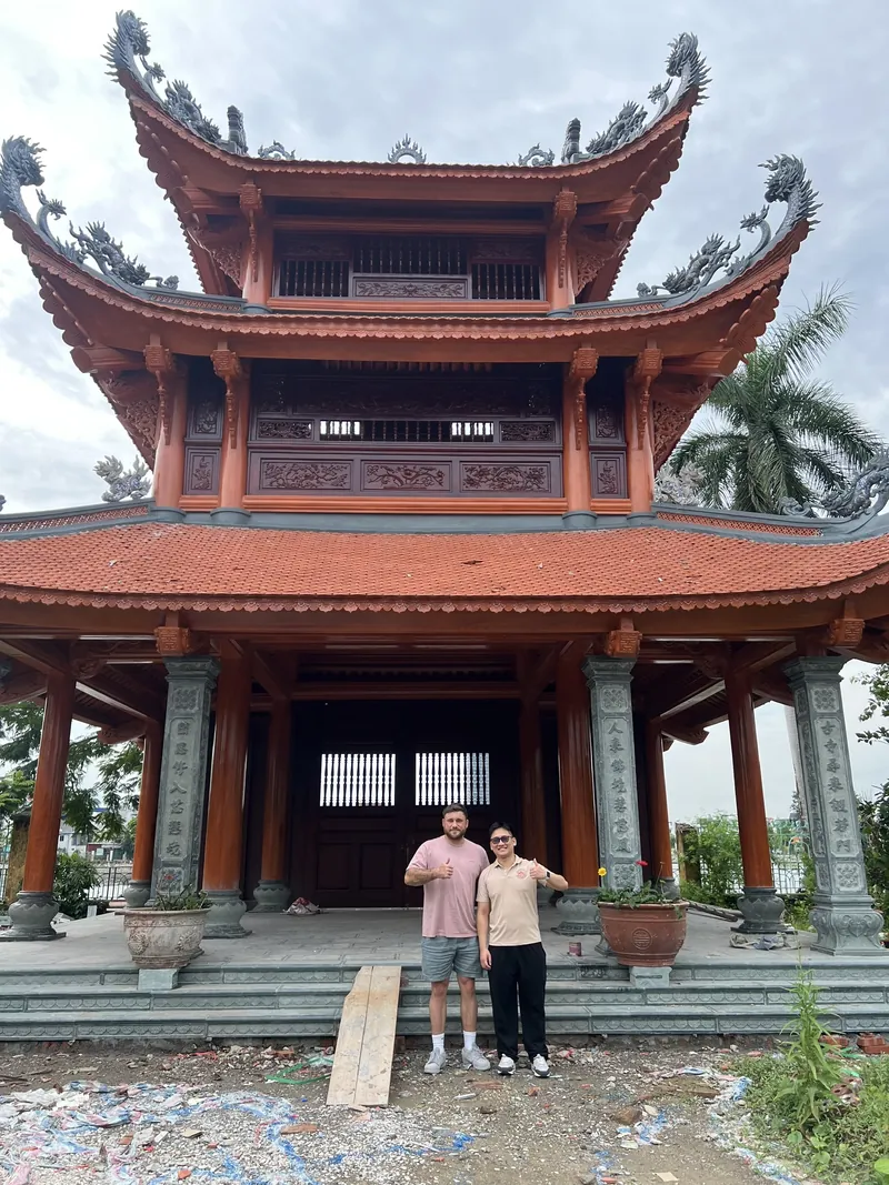
Le Chan is a good area for food. Narrow streets hide small stalls serving crab noodle soup, rice cakes and fresh spring rolls, many of them open only for a few hours. Linh Quang Pagoda, with its red-roofed bell tower, is another easy stop in this part of the map.
>>> My Haiphong Street Food Adventure Local Taste
Kien An lies further south-west and feels like a separate small city. It is mostly residential and commercial, with local markets, schools and quiet lanes. Few tourists come here, which is exactly why some travelers like it. If you ride a motorbike with a guide, Kien An is a good gateway to the quieter roads leading toward the countryside.
Hai An, Cat Bi Airport And The Eastern Side
East of the center, Hai An district is where Cat Bi International Airport is located. It is only a short drive from the center, typically around fifteen to thirty minutes depending on traffic, which makes Haiphong one of the easiest northern cities to reach by air and then explore on short hops.
Hai An also contains parts of the city’s modern port zone and some newer residential areas. There is less to see as a tourist, but its position matters on the map. If you arrive by plane, you will pass through here first. If you plan a road trip toward the coast, you will likely leave the city through this side.
Many visitors combine an airport arrival with a first night in Ngo Quyen, because hotels, restaurants and sights are concentrated there. This avoids long taxi rides every day and lets you walk more.
Recommended tour

Let a local guide connect the main districts for you, with hidden corners, local food and the stories behind the sights, so you never have to read the map alone.
From $79 per person
Do Son: The Beach Corner Of The Map
About twenty kilometers south-east of the center, the Do Son peninsula reaches into the sea. This is the city’s classic beach getaway, with a long coastline, seafood restaurants, small hotels and a relaxed resort feel. Locals come here on weekends, especially in the warm months.
Do Son works well as a half-day or full-day trip. The road follows the coast for part of the way, and a motorbike or private car gives you freedom to stop at temples, viewpoints and fishing villages. Water quality and crowds vary by season, so check recent conditions before you plan a swim.
For scenic riding between the city and the coast, read our guide to Haiphong motorbike tour routes for scenic views, which describes the best roads and viewpoints.
Cat Hai, Cat Ba And Lan Ha Bay: The Island World
Look at the south-eastern edge of any haiphong map and you will see a scatter of islands. Cat Hai district includes Cat Ba, the largest island in the group and a favorite base for kayaking, hiking and boat trips. Lan Ha Bay lies just beside it and is known for quiet limestone scenery that feels less busy than the more famous bays nearby.
Getting there takes a mix of road and water. Most travelers go by road from the city and then cross by ferry or fast boat, and the exact route depends on where you are staying and what time you travel. Schedules, ticket prices and boat operators change, so always confirm the latest details before you go. Our practical notes on the Haiphong to Cat Ba journey by ferry and bus cover the main options.
Plan at least one night on the island if you can. A same-day return is possible, but you will spend a large part of the day in transit. With a night on Cat Ba you can enjoy a sunrise, a slow breakfast and a full day on the water.
>>> Haiphong To Cat Ba Travel Time And Schedule Info
The Countryside: Thuy Nguyen, An Duong And Beyond
West and north of the city, the map turns green. Districts such as Thuy Nguyen, An Duong and Kien Thuy mix rice fields, small temples, brick lanes and village markets. This side of Haiphong is a good match for slow motorbike rides, and it gives you a very different view from the city streets.
Traffic is lighter outside the center, but roads can be narrow and surfaces uneven. Ride carefully, avoid night riding in rural areas, and consider a guide if you are not confident on a motorbike. Our article on exploring rural villages by motorbike shows what a typical day in this area looks like.
Travelers heading further afield can use the city as a base for trips to Hanoi, Ha Long and Ninh Binh. Haiphong sits on the main transport corridors, which is one reason it makes a good base for exploring the north.
Getting Around The Haiphong Map
Understanding the layout is only half the job. The other half is choosing how to move between areas. Here are the main options, with their strengths.
Walking
Walking is ideal in Ngo Quyen and along the river. Distances are short, the streets are shaded and you will stumble on small cafes and street stalls you would miss in a car. Carry water, wear a hat and avoid the middle of the day in summer.
Ride-hailing And Taxis
Ride-hailing apps and metered taxis are convenient for crossing the city, for airport transfers and for going out at night. Always check the price in the app or agree on the method before you start, and keep small notes for payment.
Motorbike
A motorbike is the most flexible way to link the city, Do Son and the countryside, but traffic can feel intense for new riders. If you plan to rent one, read about scams to avoid with motorbike rental in Haiphong first, and always wear a good helmet. Many travelers prefer to ride on the back of a local guide’s bike, which removes the stress of navigation.
Train, Bus And Ferry
For longer trips, trains and buses connect the city with Hanoi, and ferries link the mainland with the islands. Timetables and fares change, so check the latest information close to your travel date. If you arrive from the capital, our write-up on taking the train from Hanoi to Haiphong explains what to expect.
>>> Free Things To Do In Haiphong For Budget Travel
Sample Itineraries Using The Map
Once you know the areas, planning gets easy. These sample plans group places that sit close together, so you spend more time exploring and less time in traffic.
One Day In The City
Start in Ngo Quyen with coffee near the Opera House, then see the post office and the surrounding colonial streets. Move to the Cam River and Cau Quay in the late afternoon. Finish in Le Chan with street food and an evening visit to the Le Chan statue square.
Two Days With The Coast
Spend the first day in the city as above. On the second day, head to Do Son in the morning for a coastal ride and seafood lunch, then return to the center for a relaxed evening.
Three Days With The Islands
Keep day one in the city, travel to Cat Ba on day two and stay overnight, then spend day three on a kayak or boat trip around Lan Ha Bay before returning to the mainland. Times for transport vary, so leave some buffer if you have a flight or train afterwards.
Prefer to skip the planning? Haiphong Adventure builds routes like these every week, from short city rides to multi-day journeys across the north. You can tell us your dates and interests, and we will match the plan to your pace.
FAQ About The Haiphong Map
How big is Haiphong, and can I walk around it?
Haiphong is a large city, but the central area around the Opera House is compact and walkable. For Do Son, Cat Ba and the countryside you will need a vehicle, a guide or public transport.
Which area is best for first-time visitors to stay in?
Ngo Quyen is usually the best choice, because it is close to the main sights, cafes and restaurants, and it feels safe and easy to navigate. Stay near the Opera House for the shortest walks.
How far is the airport from the center?
Cat Bi Airport is in Hai An district and is usually a short drive from the center, often fifteen to thirty minutes. Traffic can change this, so leave a little extra time.
Do I need a motorbike to see Haiphong?
No. You can see the main city sights on foot and with taxis. A motorbike or private driver becomes useful if you want to reach the coast, villages and quieter areas in one day.
Is it better to explore alone or with a local guide?
Both work. Exploring alone is cheap and flexible, but a local guide helps you read the map faster, find the best food and understand the history behind each place.
Plan Your Haiphong Trip With Local Help
A haiphong map looks complicated at first, but it becomes simple once you see the pattern: a walkable colonial center, a working riverfront, local neighborhoods to the south, beaches to the east and islands beyond. Pick two or three areas, link them sensibly and leave time to slow down.
If you want a local to handle the route, the driving and the best stops, message us and we will help you build a plan. Contact Haiphong Adventure on WhatsApp, Viber or WeChat at +84(0)934.555.001, or on KakaoTalk and Line with the ID haiphongadventure. Our team will reply with suggestions for your dates.