
Scenic Views On Haiphong To Cat Ba Route Guide
Most people think of the trip from Haiphong to Cat Ba as the boring bit before the bay. We see it differently. In under three hours you go from a busy river port with French-era streets to one of the longest sea bridges in Vietnam, past a deep-water container terminal, across a quiet fishing island, over a channel dotted with limestone peaks, and up into the green hills of Cat Ba. Few transfers in northern Vietnam pack in that much variety.
This guide follows the route stage by stage and tells you what to look for out of the window, which side to sit on, where you can actually stop and how to get decent photos from a moving bus or boat. We cover the road and car ferry route that most travellers take, with notes on the river speedboat for comparison. For the nuts and bolts of transport options and planning a full trip, read our guide to planning a perfect Cat Ba tour from Haiphong city first; this one is about the views.
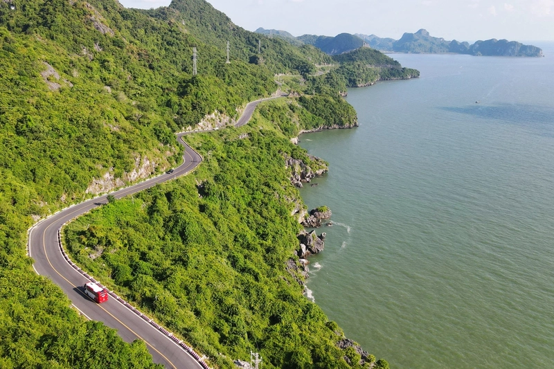
Two Routes From Haiphong to Cat Ba, Two Kinds of Scenery
The road route heads east through the port districts, crosses the Tan Vu–Lach Huyen bridge onto Cat Hai, takes the car ferry from Got pier to Cai Vieng on Cat Ba, and finishes with a hill road down to Cat Ba town. Its strengths are variety and the chance to step out on the ferry deck. Most travellers spend around 1.5 to 2.5 hours on it, depending on traffic and waiting time. Our guide to Haiphong to Cat Ba travel time and schedules covers the timings in more detail.
The speedboat from Binh pier follows the Cam River out of the city and runs across open water to Cat Ba town. It gives you a sailor’s view of the port and estuary, but windows are often small and salt-sprayed, and on choppy days you will be holding on rather than taking photos. If scenery is your priority, we usually recommend the road route on the way out and, if the sea is calm, the boat on the way back for contrast.
When the Light Is Best
Morning departures are our favourite. Heading east in the morning puts the sun ahead and slightly to the right, which makes the sea sparkle from the bridge, while the karsts at Got are softly lit from the side by the time you reach the ferry. Late afternoon on the return gives warm light on Cat Hai’s fishing boats and a chance of sunset colours over the port.
Season matters too. Autumn, roughly from September to November, often brings the clearest skies once storms pass. Winter and early spring can be hazy or foggy, which flattens long views but gives the karsts a moody, layered look. Summer is bright and green, with dramatic clouds, but also heat, crowds and the occasional storm.
What to Bring for the Ride
- A phone or camera with a short zoom. Wide-angle shots from a bus rarely capture the bridge; a slight zoom works better.
- A microfibre cloth to clean the window or lens, especially on the speedboat.
- A dark top, if you want to cut window reflections by holding your lens close to the glass.
- Sunglasses, a hat and water for time on the ferry deck.
- Charged batteries. The best views come late in the journey.
Recommended tour

The Luxury Halong Bay Tours

Cruise among the limestone islands of Ha Long Bay on a comfortable day trip with caves, kayaking options and a relaxed lunch on board.
From $109 per person
The Cam River and Haiphong Waterfront
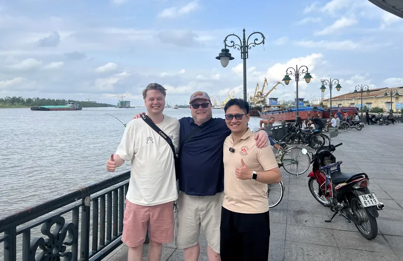
The journey starts, in spirit, on the Cam River, the waterway that made Haiphong a port. Before you leave, walk the riverside promenade near Hoang Van Thu Bridge, where cargo boats, sand barges and fishing vessels slide past the city. If you take the speedboat, you will see this stretch from the water as the boat pulls away from Binh pier, with shipyards, warehouses and cranes lining the banks.
By road, you see less of the river, but the drive out through the eastern districts shows a different side of the city: wide new avenues, logistics yards and the steady stream of container trucks that keep Haiphong’s economy moving.
The Bach Dang Estuary and Its Story
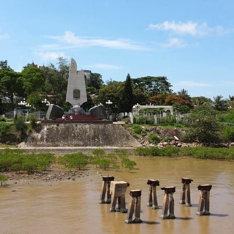
East of the city, the Cam River joins a wider system of channels around the Bach Dang River on their way to the sea. The name is famous in Vietnam. Over the centuries, Vietnamese commanders defeated invading fleets here by driving sharpened wooden stakes into the riverbed and luring enemy ships onto them as the tide fell. The best known of these battles was the 1288 victory over the Mongol-Yuan fleet under Tran Hung Dao.
From the speedboat you get a real sense of the tidal flats and wide water that made that tactic work. On the road route the estuary is mostly glimpsed between buildings, but if history interests you, the Bach Dang stakes monument on the riverbank in the Thuy Nguyen area makes a worthwhile separate outing from the city.
The Port Skyline Around Dinh Vu
Whichever route you take, you pass through Haiphong’s industrial port zone. It is not pretty in the classic sense, but it is impressive: gantry cranes, stacked containers in every colour, oil tanks and ships queuing in the channel. Photographers who like industrial lines and scale will find plenty to shoot, especially in soft morning light or at dusk when the cranes are lit up.
For many travellers this is the first moment on the Haiphong to Cat Ba drive when the scale of the city’s port really sinks in. Keep in mind that port areas have security rules. Photos from a public road or from your seat are fine, but do not wander into port gates or restricted zones for a better angle.
The Tan Vu–Lach Huyen Sea Bridge
This is the highlight of the road route for many travellers. Opened in 2017, the Tan Vu–Lach Huyen bridge runs for more than 5 km over the sea, linking the Dinh Vu area with Cat Hai island, and it was one of the longest sea-crossing bridges in Vietnam when it opened. On a clear day you look out over open water on both sides, with fishing boats, cargo ships and, in the distance, the first outlines of islands.
Stopping on the bridge is not allowed and would be dangerous, so plan to shoot from your seat. Sit on the right-hand side heading towards Cat Ba for the seaward view, open your camera before you reach the ramp, and use burst mode to catch the moments when railings and lamp posts are not in the frame.
Lach Huyen Port and Its Giant Ships
As you come off the bridge onto Cat Hai, look out for the Lach Huyen deep-water port, built to handle much larger container ships than the older river terminals in the city. On some days you will see a huge vessel being loaded beneath towering cranes, a striking contrast with the wooden fishing boats just a few minutes further on. It is a reminder that this quiet-looking corner of the coast is one of northern Vietnam’s main gateways to the world.
Cat Hai Island and Its Fishing Life
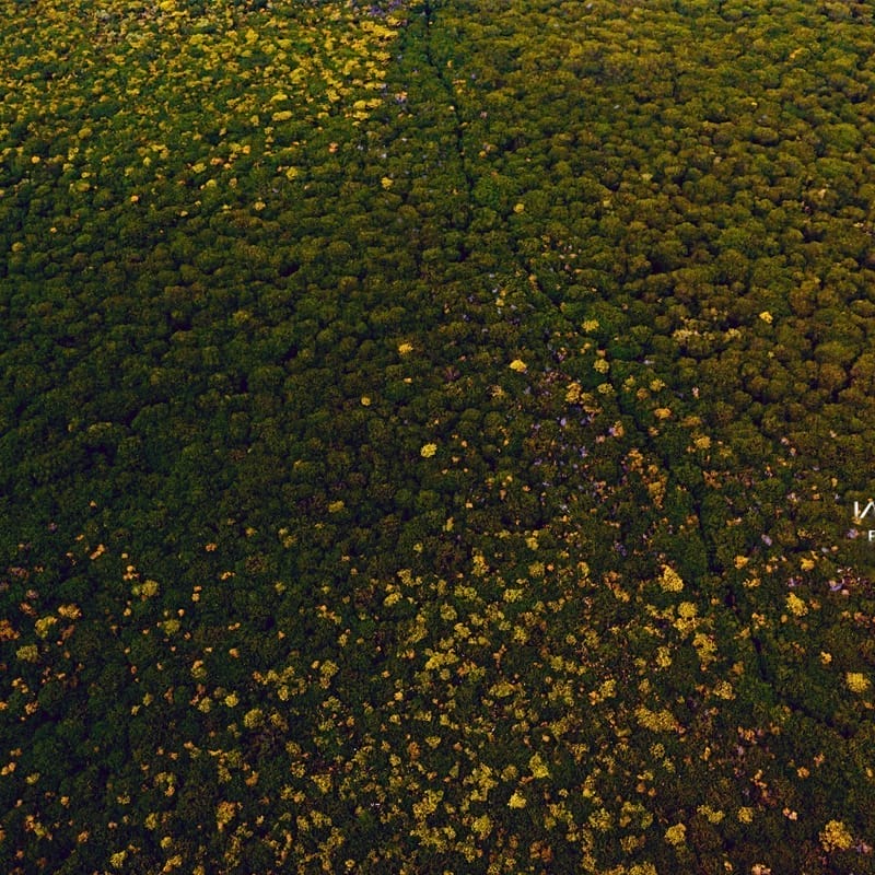
Cat Hai is a small, flat island that most visitors cross without a second thought. Look closer and it is full of coastal life: fishing boats pulled up in small harbours, nets drying by the road, aquaculture ponds and patches of mangrove along the shore. The island has a long tradition of fishing and salt-making, although how much salt production you will see depends on the season.
If you are travelling with a private driver, Cat Hai is the easiest place on the route to pull over safely for a few photos of boats and wetlands before the ferry. On a public bus, keep your camera ready for the stretch just before Got pier.
The Got Ferry Crossing
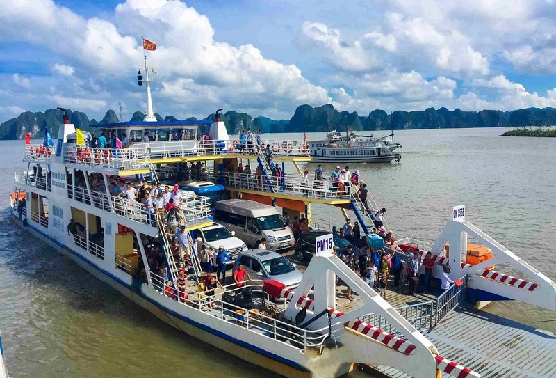
This is where the scenery changes completely. As the ferry leaves Got pier, the first limestone karsts rise out of the water ahead, the same kind of landscape that makes Ha Long Bay and Lan Ha Bay famous. Since 2023, the Cat Ba archipelago has been part of the Ha Long Bay UNESCO World Heritage site, and this short crossing is your first taste of it.
Get out of the vehicle if your operator allows it and find a spot on the deck rail. The crossing is short, so do not spend it queuing for a drink. You may also see the cable car linking Cat Hai and Phu Long overhead; its operating status changes, but even from below it adds an interesting line to photos.
The Cat Ba Hill Road and Coastal Views
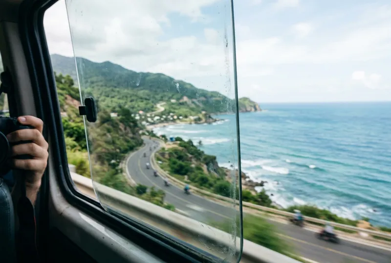
From Cai Vieng pier, the road climbs into Cat Ba’s forested hills. On the left and right you will see valleys, small farms and steep limestone slopes covered in jungle, part of the wider area protected as Cat Ba National Park and the Cat Ba Biosphere Reserve. The road then winds down towards the south coast, and suddenly the harbour of Cat Ba town appears, full of colourful fishing boats with karst islands behind.
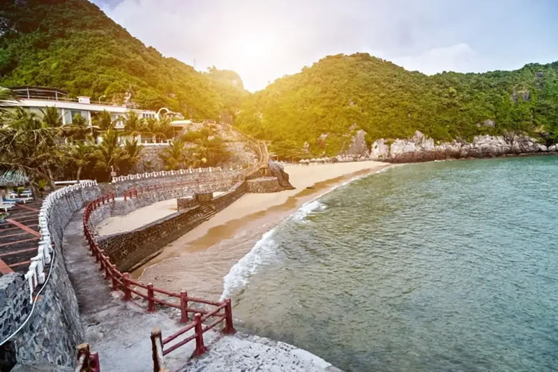
Once you arrive, the coastal road from town towards the Cat Co beaches and around the bay gives some of the best easy viewpoints on the island, especially in late afternoon. It is the perfect first walk after the journey.
Photo Tips for the Haiphong to Cat Ba Route
Shooting From a Moving Vehicle
Use a fast shutter speed or your phone’s sports or burst mode. Press the lens close to the glass to cut reflections, and shoot slightly ahead of you rather than straight sideways, which reduces motion blur.
On the Ferry
Include something in the foreground, such as the ferry rail, a motorbike or another passenger looking out, to give the karsts scale. Once you are out among the islands, our Lan Ha Bay photography guide has more ideas for framing the karsts. Watch your footing and stay clear of vehicles moving on and off the ramp.
Respect People and Places
Ask before photographing fishermen and families up close. Drones need permission in Vietnam and are not appropriate around ports or military areas, so leave yours in the bag unless you have checked the rules and have approval.
A Slow Scenic Itinerary for the Journey
If you have a private car or join a guided transfer, here is how we like to turn the trip into a half-day experience:
- Early morning – Coffee by the Cam River near Hoang Van Thu Bridge, watching the river traffic.
- Mid-morning – Drive east through the port zone and across the Tan Vu–Lach Huyen bridge, sitting on the right side.
- Late morning – A short photo stop at a safe spot on Cat Hai to see fishing boats and wetlands.
- Midday – Car ferry from Got to Cai Vieng, out on deck for the first karsts.
- Early afternoon – Hill road to Cat Ba town, lunch and check-in.
- Late afternoon – Walk the coastal road towards Cat Co for sunset views.
The next day, head onto the water. Lan Ha Bay is right on Cat Ba’s doorstep, and our team can help you choose a boat trip through Lan Ha Bay or kayak day that suits you.
Seeing the Route Again on the Way Back
The return from Cat Ba gives you a second chance at everything you missed. The light is different, you know what is coming, and you can sit on the other side of the vehicle. Coming down from the hills towards Cai Vieng in the afternoon, the channel below can glow silver, and the ferry crossing back towards Got often has softer, warmer light than the morning trip out.
If you return late in the day, the sea bridge and the cranes at Dinh Vu start to light up as dusk falls, which is a very different picture from the morning. Many travellers who rushed the outbound Haiphong to Cat Ba leg find the return is when they finally put the phone down and just watch.
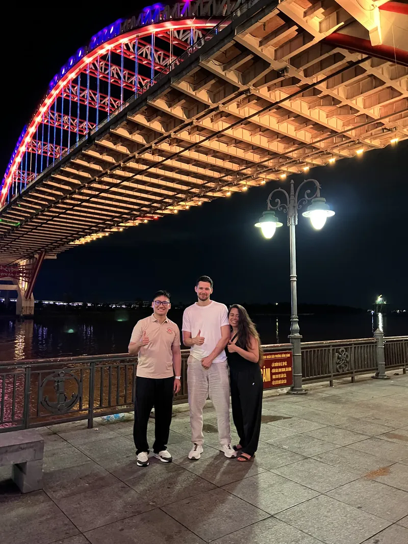
And if you arrive back in the city in the evening, finish the journey properly: a walk along the Cam River under the lights of Hoang Van Thu Bridge, followed by a bowl of something hot from a street stall. Our tips for a real Haiphong food tour will point you in the right direction.
FAQ: Scenic Views From Haiphong to Cat Ba
Which side of the bus should I sit on for the best views?
Heading from Haiphong towards Cat Ba, the right-hand side usually gives the best sea views on the Tan Vu–Lach Huyen bridge. On the way back, switch to the left.
Can I stop on the Tan Vu–Lach Huyen bridge for photos?
No. Stopping on the bridge is not permitted and is unsafe. Take your photos from your seat while moving, or stop on Cat Hai after the bridge if you have a private vehicle.
Is the speedboat or the road route more scenic?
The road route offers more variety and the open ferry deck. The speedboat shows the river and estuary from the water, but its windows are often small and spray-covered, and it is bumpier on windy days.
What is the best time of year for clear views?
Autumn often has the clearest skies after storms pass. Winter and early spring can be hazy or foggy, while summer is green and bright but busier and hotter.
Will I see Lan Ha Bay from the ferry?
You will see karst islands of the same landscape from the Got crossing, but the most beautiful parts of Lan Ha Bay are best reached by boat from Cat Ba town.
Can I fly a drone along the route?
Drones require permission in Vietnam and are especially sensitive around ports and the sea bridge. Unless you have approval, keep it packed.
Plan a Scenic Trip With Our Local Team
Treat the road from Haiphong to Cat Ba as part of your holiday and it pays you back with river life, a sea bridge, giant ships, fishing villages and your first sight of the karsts. A little planning, a window seat on the right side and a few minutes on the ferry deck make all the difference.
Haiphong Adventure is based in the city, and we are happy to help you time the journey, arrange a private transfer with photo stops, or combine a few hours of haiphong tours in the city with your trip to the island. For bay days, have a look at our Ha Long Bay tours, or check the Cat Ba options page and message us for what is currently available.
WhatsApp, Viber, WeChat: +84(0)934.555.001
KakaoTalk, Line ID: haiphongadventure